![](/images/other/stat-length.png)
![Excursión Bici de montaña Les Villettes - Espace VTT FFC Le Velay des 3 Rivières - N°8 Le Petit Moulinet Les Villettes - Photo](https://media.geolcdn.com/t/1900/400/ext.pjpeg?maxdim=2&url=https%3A%2F%2Fservices.sitytrail.com%2FGeolivesWS%2FDownloadMedia.ashx%3FTrailID%3D101771%26Media%3D2044_1.jpg)
Espace VTT FFC Le Velay des 3 Rivières - N°8 Le Petit Moulinet Les Villettes
tracegps
Usuario
![Longitud](/images/other/stat-length.png)
![Altitud máxima](https://static1.geolcdn.com/siteimages/upload/files/1508320355ic_sort_altitude_max_24dp.png)
![Desnivel positivo](https://static1.geolcdn.com/siteimages/upload/files/1508320355ic_sort_den_pos_24dp.png)
![Km-Effort](/images/other/stat-length.png)
![Altitud mínima](https://static1.geolcdn.com/siteimages/upload/files/1508320355ic_sort_altitude_min_24dp.png)
![Desnivel negativo](https://static1.geolcdn.com/siteimages/upload/files/1508320355ic_sort_den_neg_24dp.png)
![Boucle](https://static1.geolcdn.com/siteimages/upload/files/16400158638029165_repeat_loop_refresh_sync_direction_icon.png)
![Bici de montaña](https://static1.geolcdn.com/sitytour/trail-icons/202.png)
1h15
Dificultad : Medio
![Escanee este código QR para abrir la excursión en la aplicación SityTrail](https://capi.geolives.com/qq0zvz2zws4bq2lad0pu/sitytour/trails/101771/qr.png?size=200)
Aplicación GPS de excursión GRATIS
A propósito
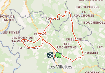
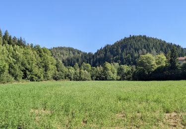
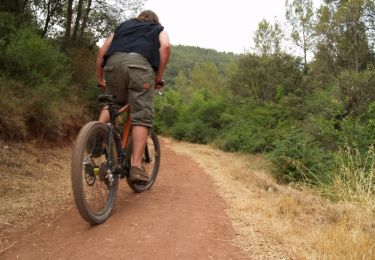
Ruta Bici de montaña de 10,7 km a descubrir en Auvergne-Rhône-Alpes, Alto Loira, Les Villettes. Esta ruta ha sido propuesta por tracegps.
Descripción
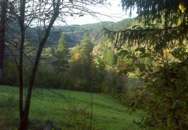
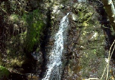
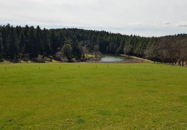
Espace VTT FFC Le Velay des 3 Rivières Circuit labellisé par la Fédération Française de Cyclisme. La pratique du VTT constituant une des demandes majeures exprimées par les touristes et la population locale, la création d'un réseau de circuits V.T.T. a été décidée. 38 circuits ont été sélectionnés représentant 327 km de chemins ou sentiers appartenant au domaine public des communes. Enfin, pour parfaire la promotion de ce produit, le territoire est agréé, par la Fédération Française de Cyclisme (F.F.C.), Espace V.T.T. En contrepartie, cette recherche de qualité et ce label apporteront une notoriété importante à la région, auprès de tous les amateurs car l'Espace V.T.T. Velay des Trois Rivières bénéficie de la promotion faite par la F.F.C. et par Chamina, au niveau national. Le topo-guide est actuellement en vente dans le réseau Chamina, dans les Offices de Tourisme du territoire et auprès du Syndicat d’Initiative.
Localización
Comentarios
Excursiones cerca
![Excursión Senderismo Saint-Maurice-de-Lignon - saint Maurice de Lignon Grazac - Photo](https://media.geolcdn.com/t/375/260/0b02680a-dda4-4a46-b011-9dfbe1ad7ce3.jpg&format=jpg&maxdim=2)
![Senderismo Senderismo](https://static1.geolcdn.com/sitytour/trail-icons/101.png)
Senderismo
![](/images/other/stat-length.png)
![](https://static1.geolcdn.com/siteimages/upload/files/16400158638029165_repeat_loop_refresh_sync_direction_icon.png)
![Excursión Senderismo Saint-Maurice-de-Lignon - 43-st-maurice-lignon-passerelle-17km-515m - Photo](https://media.geolcdn.com/t/375/260/241b1eaa-ead8-469d-9d1c-4e0139a04690.jpg&format=jpg&maxdim=2)
![Senderismo Senderismo](https://static1.geolcdn.com/sitytour/trail-icons/101.png)
Senderismo
![](/images/other/stat-length.png)
![](https://static1.geolcdn.com/siteimages/upload/files/16400158638029165_repeat_loop_refresh_sync_direction_icon.png)
![Excursión Senderismo Saint-Maurice-de-Lignon - boucle passerelle du lignon-11 km - Photo](https://media.geolcdn.com/t/375/260/d9b25bf9-cca0-431d-910e-03a9c7169afd.jpg&format=jpg&maxdim=2)
![Senderismo Senderismo](https://static1.geolcdn.com/sitytour/trail-icons/101.png)
Senderismo
![](/images/other/stat-length.png)
![](https://static1.geolcdn.com/siteimages/upload/files/16400158638029165_repeat_loop_refresh_sync_direction_icon.png)
![Excursión Senderismo Sainte-Sigolène - ste sigolene - boucle de vaubarlet - Photo](https://media.geolcdn.com/t/375/260/be2999b1-8a7c-4639-9ccb-00bd9d8be97a.jpg&format=jpg&maxdim=2)
![Senderismo Senderismo](https://static1.geolcdn.com/sitytour/trail-icons/101.png)
Senderismo
![](/images/other/stat-length.png)
![](https://static1.geolcdn.com/siteimages/upload/files/16400158638029165_repeat_loop_refresh_sync_direction_icon.png)
![Excursión Senderismo Grazac - De Charrerogne en Dunière - Vaubarlet - Photo](https://media.geolcdn.com/t/375/260/ext.jpg?maxdim=2&url=https%3A%2F%2Fservices.sitytrail.com%2FGeolivesWS%2FDownloadMedia.ashx%3FTrailID%3D172884%26Media%3D14342_5.jpg)
![Senderismo Senderismo](https://static1.geolcdn.com/sitytour/trail-icons/101.png)
Senderismo
![](/images/other/stat-length.png)
![](https://static1.geolcdn.com/siteimages/upload/files/16400158638029165_repeat_loop_refresh_sync_direction_icon.png)
![Excursión Senderismo Les Villettes - Les balcons du Lignon - Les Villettes - Photo](https://media.geolcdn.com/t/375/260/ext.jpg?maxdim=2&url=https%3A%2F%2Fservices.sitytrail.com%2FGeolivesWS%2FDownloadMedia.ashx%3FTrailID%3D129632%26Media%3D13149_6.jpg)
![Senderismo Senderismo](https://static1.geolcdn.com/sitytour/trail-icons/101.png)
Senderismo
![](/images/other/stat-length.png)
![](https://static1.geolcdn.com/siteimages/upload/files/16400158638029165_repeat_loop_refresh_sync_direction_icon.png)
![Excursión Senderismo Sainte-Sigolène - 2019 04 17 autour de Ste Sigolène - Photo](https://media.geolcdn.com/t/375/260/14d17a35-1567-4df4-93fa-d2a8de8b18eb.jpg&format=jpg&maxdim=2)
![Senderismo Senderismo](https://static1.geolcdn.com/sitytour/trail-icons/101.png)
Senderismo
![](/images/other/stat-length.png)
![](https://static1.geolcdn.com/siteimages/upload/files/16400158638029165_repeat_loop_refresh_sync_direction_icon.png)
![Excursión Otra actividad Monistrol-sur-Loire - monistrol031015_trace - Photo](https://media.geolcdn.com/t/375/260/ext.jpg?maxdim=2&url=https%3A%2F%2Fservices.sitytrail.com%2FGeolivesWS%2FDownloadMedia.ashx%3FTrailID%3D351187%26Media%3D20141004103659.jpg)
![Otra actividad Otra actividad](https://static1.geolcdn.com/sitytour/trail-icons/900.png)
Otra actividad
![](/images/other/stat-length.png)
![](https://static1.geolcdn.com/siteimages/upload/files/16400158638029165_repeat_loop_refresh_sync_direction_icon.png)
![Excursión Bici de montaña Sainte-Sigolène - Espace VTT FFC Le Velay des 3 Rivières - N°28 Vaubarlet - Ste-Sigolène - Photo](https://media.geolcdn.com/t/375/260/ext.jpg?maxdim=2&url=https%3A%2F%2Fservices.sitytrail.com%2FGeolivesWS%2FDownloadMedia.ashx%3FTrailID%3D101831%26Media%3D2108_1.jpg)
![Bici de montaña Bici de montaña](https://static1.geolcdn.com/sitytour/trail-icons/202.png)
Bici de montaña
![](/images/other/stat-length.png)
![](https://static1.geolcdn.com/siteimages/upload/files/16400158638029165_repeat_loop_refresh_sync_direction_icon.png)